
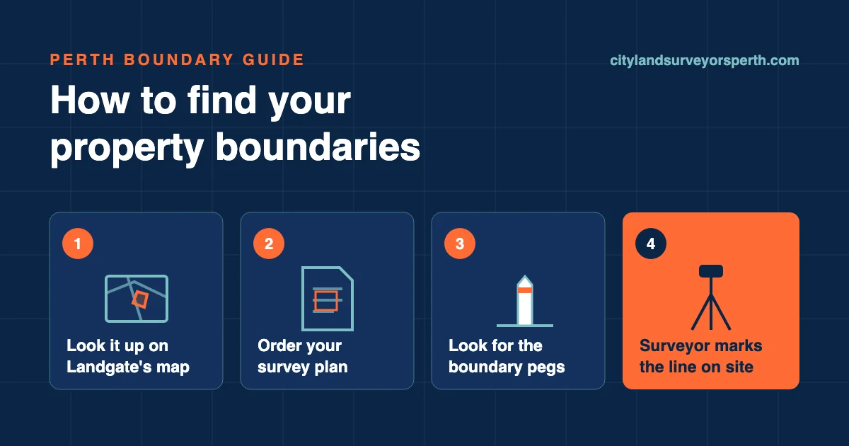
You can get a good idea of where your property boundaries are in Perth without leaving home, using Landgate's online map and the survey plan for your lot. What those records can't do is show you exactly where the line sits on the ground. For that you need the boundary pegs, and if they're missing, disturbed or disputed, a licensed surveyor to mark the corners again.
Can you see your property boundary online?
Yes, roughly. Landgate's Map Viewer Plus lets you find a property by street address, by Certificate of Title volume and folio, or by lot on plan. Turn on the cadastre (land parcel) layers and you'll see the parcel boundaries and any easements over the land. There's also a measuring tool for distances and areas.
Treat those lines as an estimate. Landgate's own guidance for surveyors covers its Spatial Cadastral Database, the digital record of land parcel boundaries. It says that in most cases the database gives "a close, but varying, estimate of the position of land boundaries" (Landgate, SPP-02 Searching Landgate Records, version 4, July 2022). The same guidance says current specifications aim for urban boundary coordinates within about 5 to 20 centimetres of their true position. That's close, but on a fence or wall built to the line, 20 centimetres matters.
Map Viewer Plus even has layers that show how accurate the coordinates and distances are likely to be. So the map is useful for seeing the shape of your block, spotting an easement, or working out roughly how far the back fence is from the house. It isn't something to set out a fence, a retaining wall or an extension from. The same goes for boundary lines on general map apps or satellite imagery: they're a picture, not a boundary record.
What your survey plan and Certificate of Title show
The survey plan is the document that matters for boundaries. Landgate describes survey plans as "the official record of the legal boundaries of land". It says they usually show the lot's size, shape and dimensions (Landgate, Survey plans and documents).
The Certificate of Title is about ownership. It records who owns the land, the volume and folio, the survey plan number and type, and registered interests such as encumbrances and caveats. Digital titles don't carry the hand-drawn sketch that some old paper titles had, so the title alone won't show you where your boundaries are (Landgate, Certificate of Title). It is still worth having, because it tells you which plan to order.
You can buy both online from Landgate using your street address, your title's volume and folio, or your lot on plan number. On 5 November 2026 Landgate listed each at $33.90 (survey plans, titles). Landgate says a title copy arrives by email within 30 minutes, and you don't need to own the property to order one.
Which plan you're looking for
The plan number on your title tells you what kind of plan covers your lot:
- DP (Deposited Plan): freehold plans lodged since July 2000, and old Crown surveys.
- P or D (Plan or Diagram): older freehold plans and diagrams lodged before July 2000.
- SP (Scheme Plan): strata, survey-strata and community title schemes.
If you own in a built strata scheme, Landgate notes the scheme plan may show a building outline and lot areas, but not always dimensions and angles. Survey-strata plans do show lot areas, dimensions and angles, so a survey-strata lot works much like a house block when you're looking for the line.
How to find the boundary pegs on your block
Boundary pegs are the marks a surveyor placed at the corners of your lot when it was surveyed. Landgate describes a survey as a licensed surveyor measuring and placing marks to show where boundaries are. It also points out that not every mark a surveyor places is a peg.
To look for them:
- Start from the survey plan. Its dimensions tell you roughly where each corner should be, measured from a corner you can find or from the front of the lot.
- Check the corners closely. Pegs can be buried, covered by garden beds, paving or concrete, or pulled out during earlier building work. Look along fence posts and paving edges near each corner, and clear mulch or loose soil by hand.
- Don't move them. If a peg is in the way of something you're planning, talk to a surveyor before you dig around it or take it out.
Finding a peg is a good sign, but it doesn't settle the question on its own. A peg can be knocked or moved over the years, and you can't tell by looking whether it is still where the surveyor put it. The same goes for fences: an existing fence shows where someone built a fence, not where the legal boundary is.
Say you're replacing a side fence and the back corner peg is under new paving. The survey plan tells you the lot's dimensions, but it takes a surveyor to put that corner back on the ground before the fence goes in. A surveyor works from the plan's measurements and the survey marks that remain nearby, which is why a missing peg can still be replaced accurately.
Which record is good enough for what you're doing?
The records tell you what your lot should measure. Only marks on the ground show where those measurements fall today.
Landgate Map Viewer Plus
- What it tells you
- Rough lot shape, easements, approximate distances
- What it can't tell you
- Exactly where the line sits on the ground
- Good enough for
- Getting a first look
Certificate of Title
- What it tells you
- Owner, title reference, plan number, registered interests
- What it can't tell you
- Boundary dimensions (digital titles have no sketch)
- Good enough for
- Confirming what you own and which plan to order
Survey plan
- What it tells you
- Official boundary dimensions, lot size and shape
- What it can't tell you
- Where those lines fall on your ground today
- Good enough for
- Checking dimensions and briefing a surveyor
Existing pegs
- What it tells you
- Where a surveyor once marked the corners
- What it can't tell you
- Whether they're still in their original position
- Good enough for
- A guide, if undisturbed and everyone agrees
Existing fence
- What it tells you
- Where a fence was built
- What it can't tell you
- Where the legal boundary is
- Good enough for
- Not a boundary record
Licensed surveyor re-marking the corners
- What it tells you
- The boundary marked on the ground
- What it can't tell you
- Legal advice about a dispute
- Good enough for
- Fencing, building near the line, settling where the line is
| Source | What it tells you | What it can't tell you | Good enough for |
|---|---|---|---|
| Landgate Map Viewer Plus | Rough lot shape, easements, approximate distances | Exactly where the line sits on the ground | Getting a first look |
| Certificate of Title | Owner, title reference, plan number, registered interests | Boundary dimensions (digital titles have no sketch) | Confirming what you own and which plan to order |
| Survey plan | Official boundary dimensions, lot size and shape | Where those lines fall on your ground today | Checking dimensions and briefing a surveyor |
| Existing pegs | Where a surveyor once marked the corners | Whether they're still in their original position | A guide, if undisturbed and everyone agrees |
| Existing fence | Where a fence was built | Where the legal boundary is | Not a boundary record |
| Licensed surveyor re-marking the corners | The boundary marked on the ground | Legal advice about a dispute | Fencing, building near the line, settling where the line is |
When you need a surveyor to mark the line
Records and pegs are often enough when you just want to know roughly what you own. You need the line marked on the ground when something is going to be built, moved or argued about on or near it. That usually means:
- you're putting up a new or replacement fence on the boundary
- you're planning an extension, shed, pool or retaining wall close to the line
- the pegs are missing or disturbed
- you and your neighbour don't agree where the boundary is
- you're buying and want to check the fences and buildings sit where they should
Landgate suggests buyers check the survey plan for property line problems or easements. If you want to know whether the buildings and fences sit inside the boundaries, an identification survey is the related job.
What you're asking for is a boundary survey, where a licensed surveyor works out the legal boundary from the survey records and re-marks the corners on site. Landgate lists marking the accurate position of the legal boundary for an existing property as one of the reasons land is surveyed. There's also a separate post on whether you need a survey before building a fence in Perth.
If building work could encroach on your neighbour's land or affect it, WA's Building and Energy has a formal notice for asking their consent, form BA20 (Building approvals). Ask your builder whether it applies to your project.
How to check a surveyor is licensed in WA
The Land Surveyors Licensing Board of Western Australia keeps a public list of licensed surveyors you can search by surname, first name or licence number. The Board is set up under the Licensed Surveyors Act 1909 and handles complaints. Under that Act, anyone practising as a Licensed Surveyor must be registered with the Board and hold a current practising certificate (LSLB).
If you and your neighbour disagree about the line
WA's dividing fence rules, under the Dividing Fences Act 1961, cover a disagreement about where the boundary is (Government of WA, Dividing fences, updated 26 June 2026):
- You can both agree to have the line set out by a land surveyor and share the cost.
- If one owner thinks a survey isn't needed, the other owner can give notice that they will engage a surveyor.
- The neighbour then has seven days either to place pegs where they think the boundary is, or to engage a surveyor themselves and recover half the cost. Either way, they must tell the first owner what they've done as soon as practicable.
- If the neighbour pegs it and the first owner still isn't satisfied, the first owner waits one month after giving notice. They can then engage a surveyor to define the line.
- If the surveyor finds the boundary where the neighbour's pegs were, the owner who called in the surveyor pays the full cost. Otherwise the cost is shared.
This is general information, not legal advice. If a dispute is already serious, get advice on your own situation before you act.
Getting your boundary marked in Perth
Start with the records: look up your lot on Map Viewer Plus and order the survey plan. If that answers your question, you may not need anything more. If you're about to build or fence near the line, the pegs are gone, or your neighbour sees it differently, have the boundary marked on the ground.
Send us the address and what you're planning through our enquiry form, or call (08) 5122 5501, and ask about a boundary survey.
Landgate prices and WA government guidance in this article were checked on 5 November 2026.
About this guide: City Land Surveyors Perth takes enquiries about land surveying in Perth. This guide is general information for property owners. Read more about us or contact us.